|
[Home] to paraglide.net [SD Log] [Amigo] [Activity] [Photo] [Comments] [Incidents] [Weather] [SBSA] [SCPA] |
| [Amigo] > [Mitch Riley flight index] |
Some flight data copied from: [www.xcontest.org/world/en/pilots/detail:mitchriley]
Note: some IGC and (and subsequent KMZ) files have been edited to trim the ends
and reconcile landing and takeoff altitude with Google Earth.
See Also: Mitch's Vimeo Page at: [https://vimeo.com/mitchriley]
or track Mitch's flights on his Delorme inReach Map Page at: [https://share.delorme.com/MitchRiley]
Mitch Riley
Flight on Wednesday,
4/19/2017 / Archive updated 9/28/2017
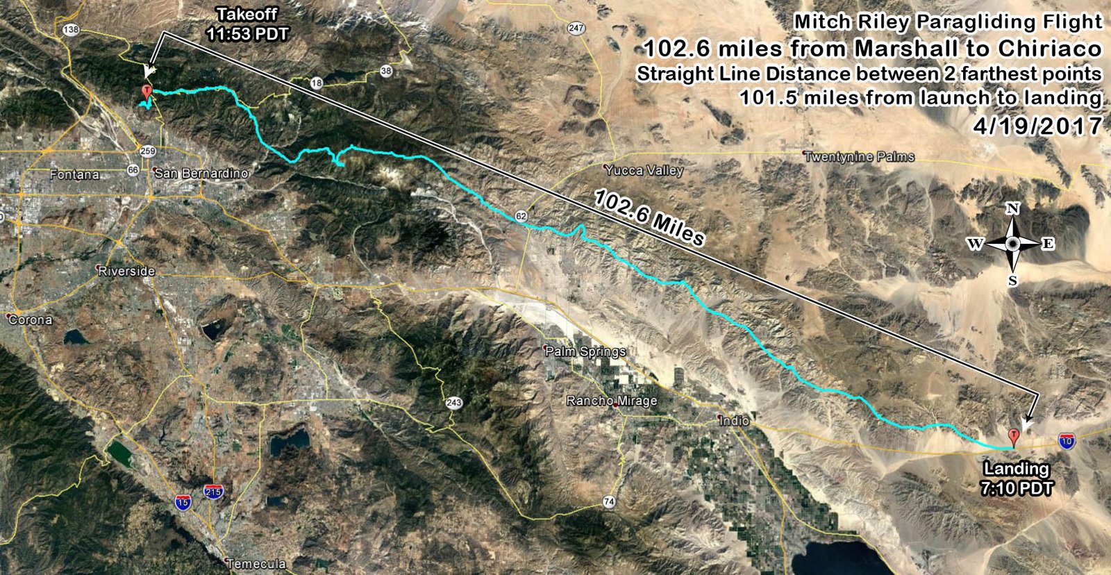
Marshall to Chiriaco ~ 102.6 miles straight line distance between the 2 farthest
flight points
or 101.5 miles from launch to landing.
Reference: [IGC Text Data File] and [Google Earth KMZ File] or [Doarama Animation]
Click Image ↓ for Full Size
[Top of Page] [Home]