|
[Home] to paraglide.net [SD Log] [Amigo] [Activity] [Photo] [Comments] [Incidents] [Weather] [SBSA] [SCPA] |
| [Amigo] > [Mitch Riley flight index] |
Some flight data copied from: [www.xcontest.org/world/en/pilots/detail:mitchriley]
Note: some IGC and (and subsequent KMZ) files have been edited to trim the ends
and reconcile landing and takeoff altitude with Google Earth.
See Also: Mitch's Vimeo Page at: [https://vimeo.com/mitchriley]
or track Mitch's flights on his Delorme inReach Map Page at: [https://share.delorme.com/MitchRiley]
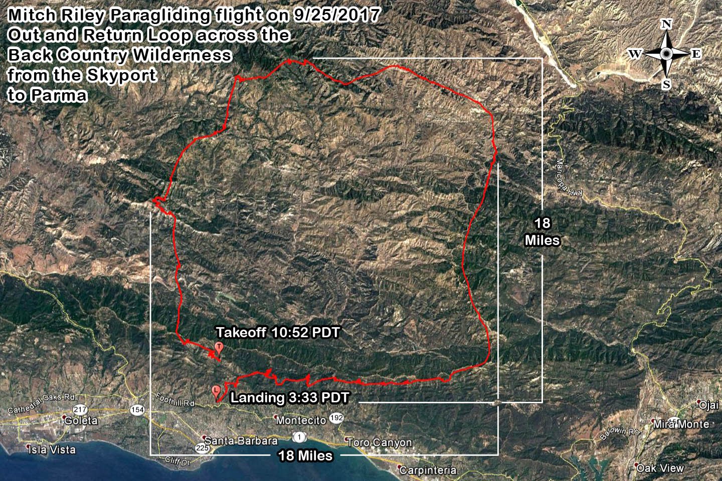
Mitch Riley
Monday, 9/25/2017
Reference: [IGC Text Data File] and [Google Earth KMZ File] or [Doarama Animation]
Click Image ↓ for
Full Size / scroll down for Mitch's narrative
Mitch's Narrative Copied from the SBSA Chat Box
... my flight yesterday. Its a line I've been studying for a couple of years now, after climbing to 7,700ft over La Cumbre I knew I had to try it. Of interesting note is my way back into the wind on the front range. It was an especially difficult section. Flying lines like this one is not for the faint of heart, unprepared, or uncommitted. A multiple day, dehydrated, hike out would have awaited me had I landed back there.
[Top of Page] [Home]