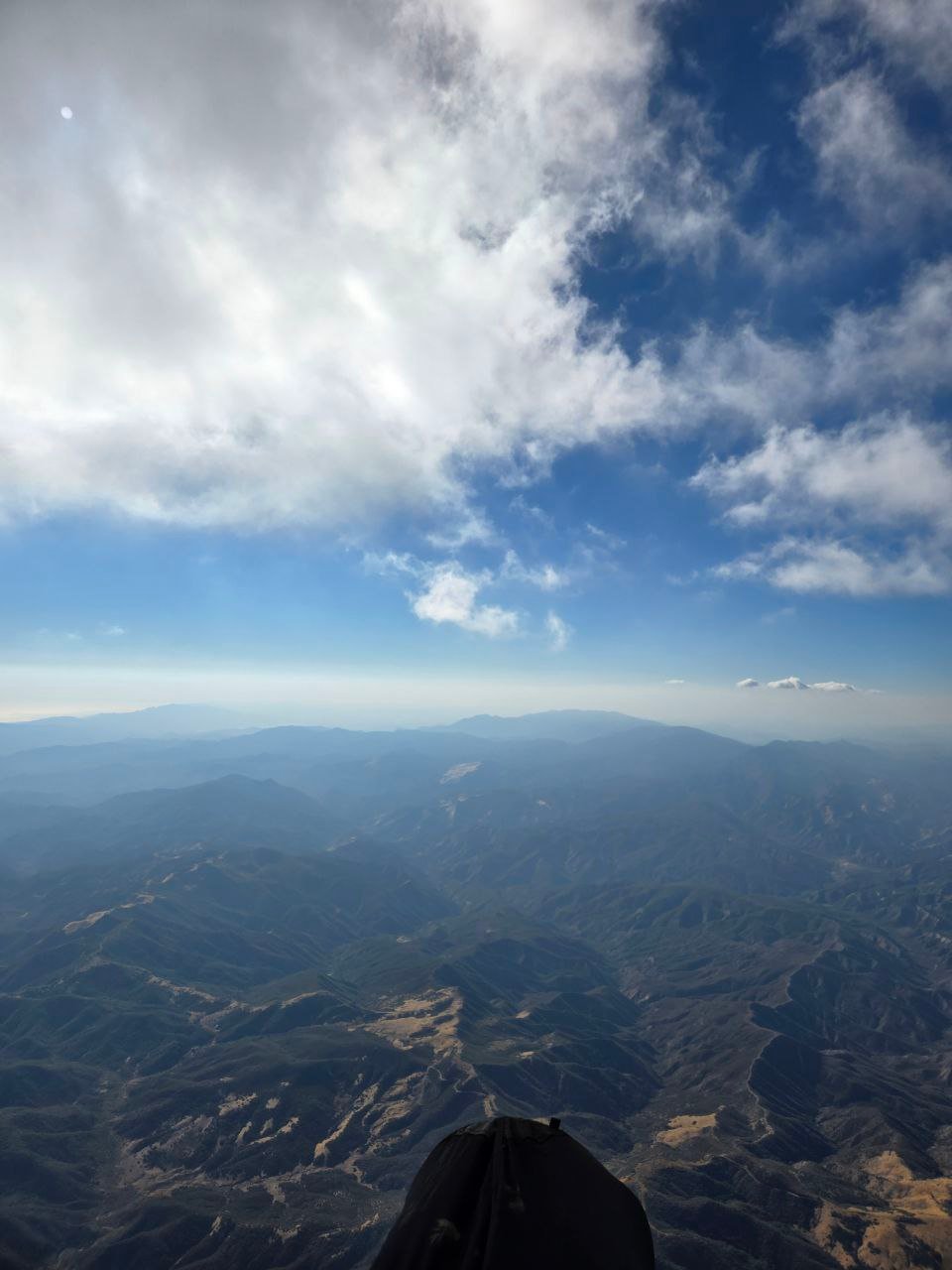
Any of the pine group back in cell service? Curious about my friend’s last reported ping 1.5hrs ago … 600ft up at that ping still, but interesting spot
|
[Home] to paraglide.net [SD Log] [Amigo] [Activity] [Photo] [Comments] [Incidents] [Weather] [SBSA] [SCPA] |
| [Amigo] > [Elise Ma archive index] |
| Saturday, 9/13/2025 [Weather] and Flight Archives by [Jeff Longcor] & [Elise Ma] |
| [Telegram Chat] [Incident Comments] [Photos] |
Elise Ma
Saturday, 9/13/2025
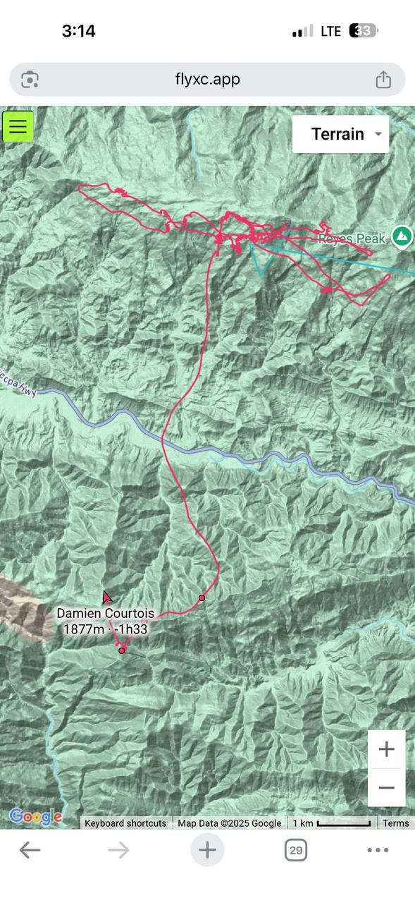
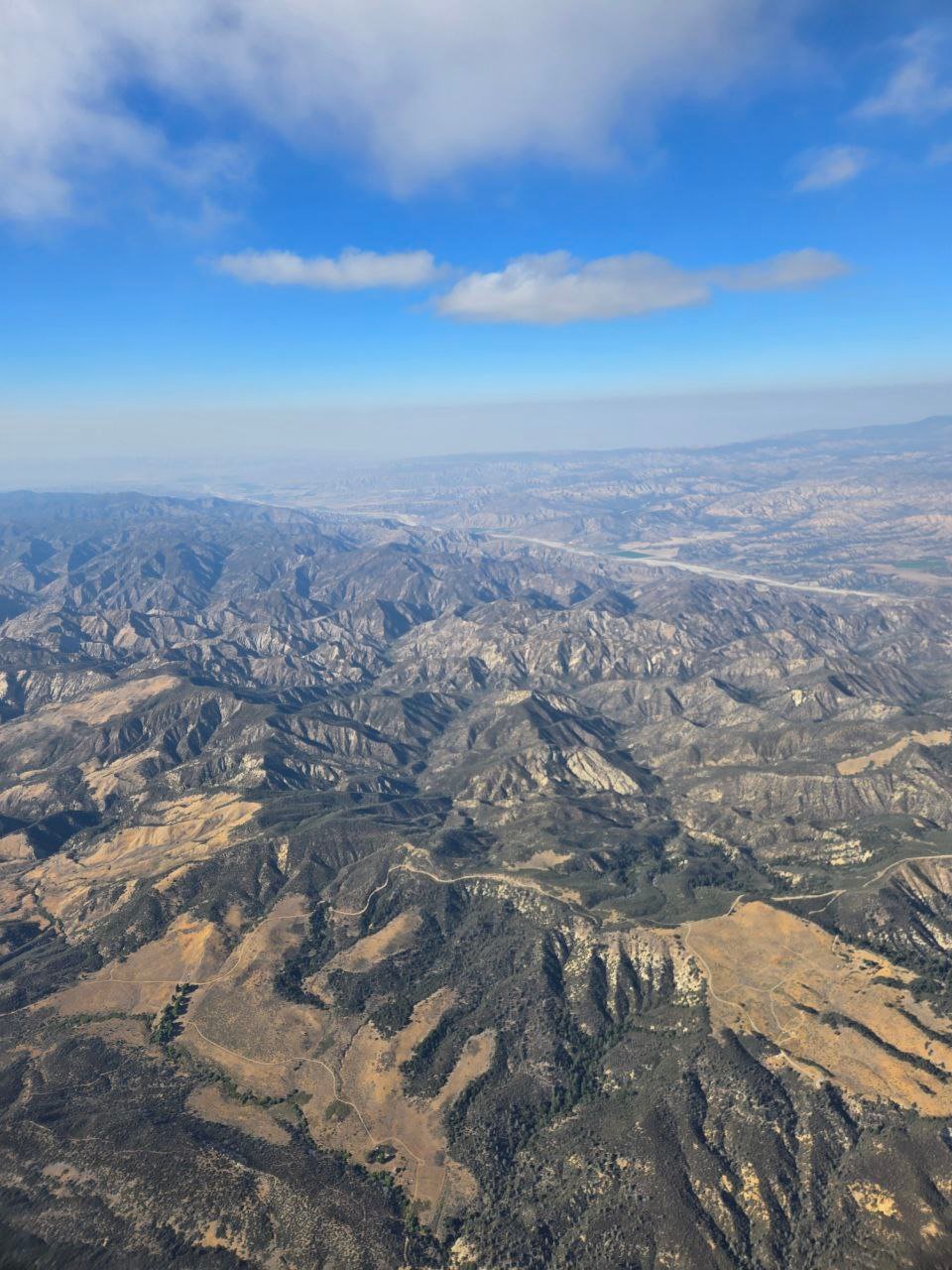
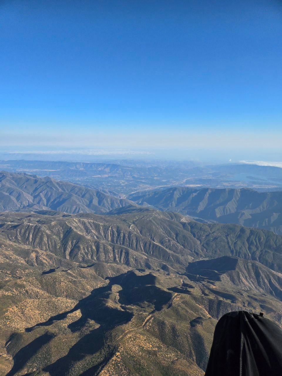
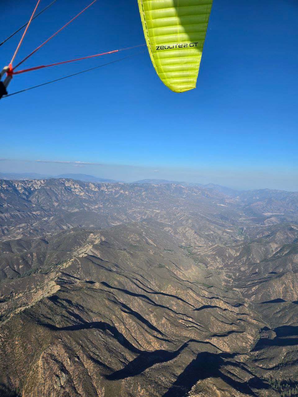
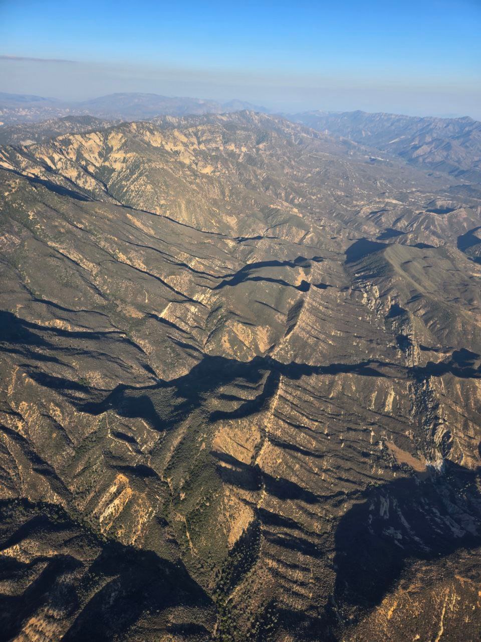
Pine SS to Rayes to Ortega
Out-Landing atop one of the spines from Ortega toward the Sespe
followed by an eventual helicopter Uber extraction about 4 hours later at
5:45-ish
Reference: [IGC Text Data File] and [Google Earth KMZ File]
5.3 Miles Straight Line Over-Flown Distance (SLOFD)
Max Altitude 10,748 Ft MSL
1 hour 6 minutes 46 seconds / Takeoff at 12:33:39 / Land at 1:40:25 PDT
Helicopter ride from Ortega to LZ about 5:45 PDT
Elise's Narrative
Copied from the SBSA Telegram General Chat
Post on Sunday, 9/14/2025 (the day after) at 9:54 AM
partially in response to Chris Garcia's comment posted (copy below) posted
earlier in the morning
Many lessons learned. I’m deeply sorry that my decisions put this community under the radar in a negative light. I recognize how very special this community is and I don’t want to put it at jeopardy. I’ll make better judgment calls and be more thoughtful flying forward.
I’m not sure what the scope is of an accident report so please let me know if I should be including more but here’s the gist.
I left the main spine next to launch around house thermal with ~10K and went towards Ortega and didn’t turn back with enough elevation to make it back to the Sandpile. The choice to continue pushing towards Ortega without enough altitude and no thermals to get up was a mistake. There were no decent LZs around Ortega hill proper and with the low altitude I ended up landing as safely as possible a little West Ortega hill.
I’m very appreciative of everyone who flew with me (Stef, Damien, Alex, Jeremy) supporting on the ground and for the SBSA for fostering and creating a culture for being so readily available, supportive, and educational, but I want to especially thank Stef and Andrew for guiding us through the non-emergency rescue situation and for getting me out safely within a few hours. Without them, SAR, and the random satellite signal that popped in this could’ve played out much worse. My first expressions on the radio after telling the crew I landed safely were I’m so sorry to be putting you all through this and thank yous. That sums up my general feeling towards the situation outside of the flying portion.
Going forward, I’m:
Tom asked for my IGC file, which I’ll share with him. If anyone else has questions or wants context, lessons, etc. feel free to reach out to me...
Chris Garcia Comment
intended to address recent local incidents resulting in SAR
helicopter "rescues" including:
Posted to the SBSA Telegram General Chat on Sunday, 9/14/2025
with a couple of minor insignificant edits.
We are off to rough start this season. When we land on sensitive areas, or have to call SAR on a continual basis and we end up on John Palminteri’s social page, it’s not a good look for us as a community. I’m really glad that all the recent events have come out positively for the most part.
Radios / Fly with one, know how it works, keep your chatter to a minimum and
allow for pertinent information to come through. Communicate thoughtfully
and clearly.
http://www.scpa.info/committee/radio/protocol.htm
Offline maps / We all fly with a phone and have Google Maps. Take the time to download offline maps there or get Gaia and download those maps so you have trails and you can even download satellite view so you can find a clearing if you’re in dense brush.
Garmin inRreach / Get one, know how to use it and share your link with friends. It’s a safety device that every pilot should have and fly with.
Study Up / Flying a new site or trying a new route requires planning. Understand the consequences of not making the LZ, or what going OTB can mean. Get solid mentorship when going to a new site. If you’re not comfortable landing out then sticking to the “fish bowl” or taking sled ride to get familiar with the launch and landing is a good idea.
Self-rescue / If you are uninjured you need to be prepared to self rescue. Trekking poles, water, food, radio, garmin, off line maps. Plenty of pilots have landed deep and gotten out. But if you’re that pilot who has a bad leg/foot or one who doesn’t quite have the situational awareness built up yet maybe stick closer to home and slowly dip your toe in the water.
Fundamentals / Keep up on the kiting, spot landings, terrain clearance, etc. and all the basic stuff you learned from the get go.
The list can go on and on and I’m sure some keyboard warrior would love to keeping adding to it.
Point is that it’s your responsibility as the pilot on command to be as prepared as possible for the day of flying.
Have fun out there, but keep it together…
Chris Grantham Comment
intended to directly add to Chris Garcia's comment which was intended
to
address recent local incidents resulting in SAR
helicopter "rescues" including:
Might be worth adding that if you’re going to a site that you’re new to, or are flying in stronger conditions than your usual, have a mentor that is looking out for you, ideally one that knows the site and conditions well. If you look around the van on the way up and you are the most experienced pilot, you’re it. If you don’t feel qualified to be the mentor, let everyone else know, because odds are they’re going to be looking to you for guidance.
Often the general flight plans we dish out as part of a site briefing are based on what has been successful in the past, and avoids areas that are known to be not-so-stellar. It’s cool to explore a bit but keep the flight plan within reach so you can get back to it if you stumble into not-so-stellar territory. Those flight plans are there for your success and come from experience that you don’t have to figure out the hard way.
| Saturday, 9/13/2025 [Weather] and Flight Archives by [Jeff Longcor] & [Elise Ma] |
| [Telegram Chat] [Incident Comments] [Photos] |
Relevant Telegram Flying Today Chat from
Saturday, 9/13/2025
Jeff Loncor / Friday night (the day prior) at 9:54 PM
May end up flying Pine tomorrow late morning in case anyone else is around.
Setf Henderson / Saturday morning (the day of) at 7:39 AM
What time are you thinking?
Jeff Longcor / 7:43 AM
I'm heading up now and planning to hike up from 33. Should be on launch 1130ish.
Alex Teplitxky / 7:43 AM
Never flown Pine before but would love to. If anyone else goes today, could I
possibly get an LZ walk or site intro?
Setf Henderson / 8:15 AM
Jeremy and I are carpooling to Pine in about an hour, DM me if you're in
Tom Truax (SD) / 8:21 AM
Today, Saturday, climbing temperature under building high pressure squashing the
marine layer. Base wind is light with a variable ebb from the east to the
east and typical but light-ish NW toward Point Conception. Some of the
Windy models suggest the flow around Point Conception might pull in later in the
afternoon, but could be cross from the west when it does?
Chad might do OK at Elings today?
MP might be soarable but only to a little over ridgeline as the temperature
profile is not encouraging for XC.
The Skyport should be flyable, but likely too low to reach the good stuff?
The lapse rate gets better above our local ridgeline
Ojai looks weak down low today but better up higher toward the Bluffs. Ojai looks better tomorrow (Sunday) than today (Saturday) with a healthy lapse rate.
Pine offers a healthy lapse rate today, but the TOL is lowish for Pine, only about 9K early climbing to about 10K by mid-afternoon. The temperature profile improves through the day and by late day the lapse rate looks robust up to about 10K. Base wind is light with a little push from the north above ridgeline, so might be enough for a glide back toward Ojai? Looks like a classic N/S convergence over Lockwood Valley and down the south side of the Antelope Valley along the Liebre Mountains but going could be slow due to the east ebb and limited altitude? Tomorrow, Pine continues to look attractive for local mid-day recreational flying with a robust lapse rate, lighter base wind, and mid-day cloudbase around 10Kish.
Jeff Longcor / 8:25 AM
Thanks Tom!!
Damien Courtois / 8:47 AM
Hi! Would Pine be reasonable for P2s? We're on our way to SB with Elise and were
wondering.
Stef Henderson / 8:50 AM
Response to Damien's 8:47 inquiry
Yeah I think Pine looks relatively mellow today. It can be a little robust
for P2s on a big day midday. If you guys are coming from down south it
might be better to meet in Ojai so you don't need to backtrack
Damien Courtois / 8:50 AM
I mean at this time of day, compared to the afternoon departures from Ojai we
usually see
Stef Henderson / 8:53 AM
It might be a bit much for a P2 with 0 thermalling experience but for someone
whos comfortable with basic thermalling I think it'll probably be fine?
I'm still almost an hour out from Ojai, you have time to get a spacious
breakfast
Tom Truax (SD) / 11:40 AM
in response to Damien's inquiry about suitability for his experience level
A few years ago in September as a P3 (?) pilot, Stef had her 1st flight to
the beach from Pine.
http://paraglide.net/log/2022/09-04/2_summary.htm
Stef also took the day with a flight to CalTrans from the Pine 5,650 North Side
Launch a day earlier…
Clinic photos and video in Google Drive at:
https://drive.google.com/drive/folders/1if8Hhz1Xn7hb_jT-svdP78PMGJcoXzdE
Note that even with today’s light-ish base wind, the lapse rate will likely generate mid-day umph such that the thermal draw and cycles will be robust. Late day air is typically mellower, but you can build your bump tolerance by flying in stronger air. Don’t expect it to be mellow and smooth mid-day, but as Stef noted, today and tomorrow are likely good days at Pine for newer pilots to stretch into bigger air. We had P2 pilots achieving successful mid-day flights during the 2022 September Eagle Pine Clinic…
Tom Truax (SD) / 2:33 PM / with a 3:39 edit to update
At Pine (as of 2:30 on XCfind/inReach)
JLo launched a little after 12:30 and got close to 10K before scooting eastbound
along the range past Thorn Point. Currently somewhat committed “all in”
venturing deep into the Sespe wilderness, headed NE across the Sespe Hot Springs
to San Rafael Peak east of Matu Flat with 8,500 (2:28 breadcrumb).
Stefani launched a little before 1 o’clock and got to about 10K, but aborted her glide toward Ojai and turned around to land at Cal Trans
3:39 update: Jeff dug his way out of the wilderness and opted to turn back west toward some semblance of civilization. His 10-minute breadcrumbs from start to Turn Point is about 19.1 miles SLOF. Currently over the Splitter, crossing the gap between Thorn and Decision. I presume he will tag Pine and then we’ll need to see where he goes? I think his car might be at the Sand Pile so he may choose to land there? But it is still early in the day…
Andrew Karnowski / 3:19 :PM
Any of the pine group back in cell service? Curious about my friend’s last
reported ping 1.5hrs ago … 600ft up at that ping still, but interesting spot
Tom Truax (SD) / 3:40 PM
in response to Andrew's inquiry about Damien
Damien Curtois isn't listed on XCfind. Does anyone know what his inReach URL (Link) is? Not listed on his Telegram Bio either.
No cell coverage in that area...
In the past I've had to drive to to top of the gap overlooking the north fork of
Matilja Creek to get cell service to find pilots via their inReach, then
backtrack to collect them...
Looks like Damien has enough altitude to abort north to Hwy 33 near the Sand Pile or Half Moon, or he could go east to CalTrans where Stef landed?
Damien Courtois / 3:48 PM
All good, we all landed safe, just out of cell service.
We're figuring out how to best retrieve Elise right now.
Tom Truax (SD) / 3:49 PM
in response to Damien's quandary about retrieving Elise
I don't think Elise has an inReach?
3:51 PM
Is anyone in radio contact with Jeff Longcor? If so, he might appreciate
some assistance with his vehicle (at the Sand Pile?) which could enable him to
reach further?
Jeff is currently (3:49) at 8K over Haddock / Westbound toward Pine...
Alex Teplitxky / 3:58 PM
Hi all, we could use some support. Everyone is safe. Elise landed
deep in the foothills between Ortega ridge and the Sandpile. We have
determined that it’s an unrealistic bushwack back to the highway. She
needs non-emergency SAR support for the following coordinates. We have
very limited service, can someone please call?
34.575870 N 119.320612 W
Elise Ma / 4:06 PM (about 3-1/2 hours after landing)
Google Maps Location
Please and thank you. I’m safe but it’s all bushes here and the trail is
too far to get to before dark
Andrew Karnowski / 4:07:PM
On phone with sheriff dept now
Elise Ma / 4:09 PM
So sorry for the trouble
Thank you Andrew
I get one bar of service here and there
If I don’t respond it’s because it’s out for a moment
Andrew Karnowski / 4:09:PM
Description of clothing
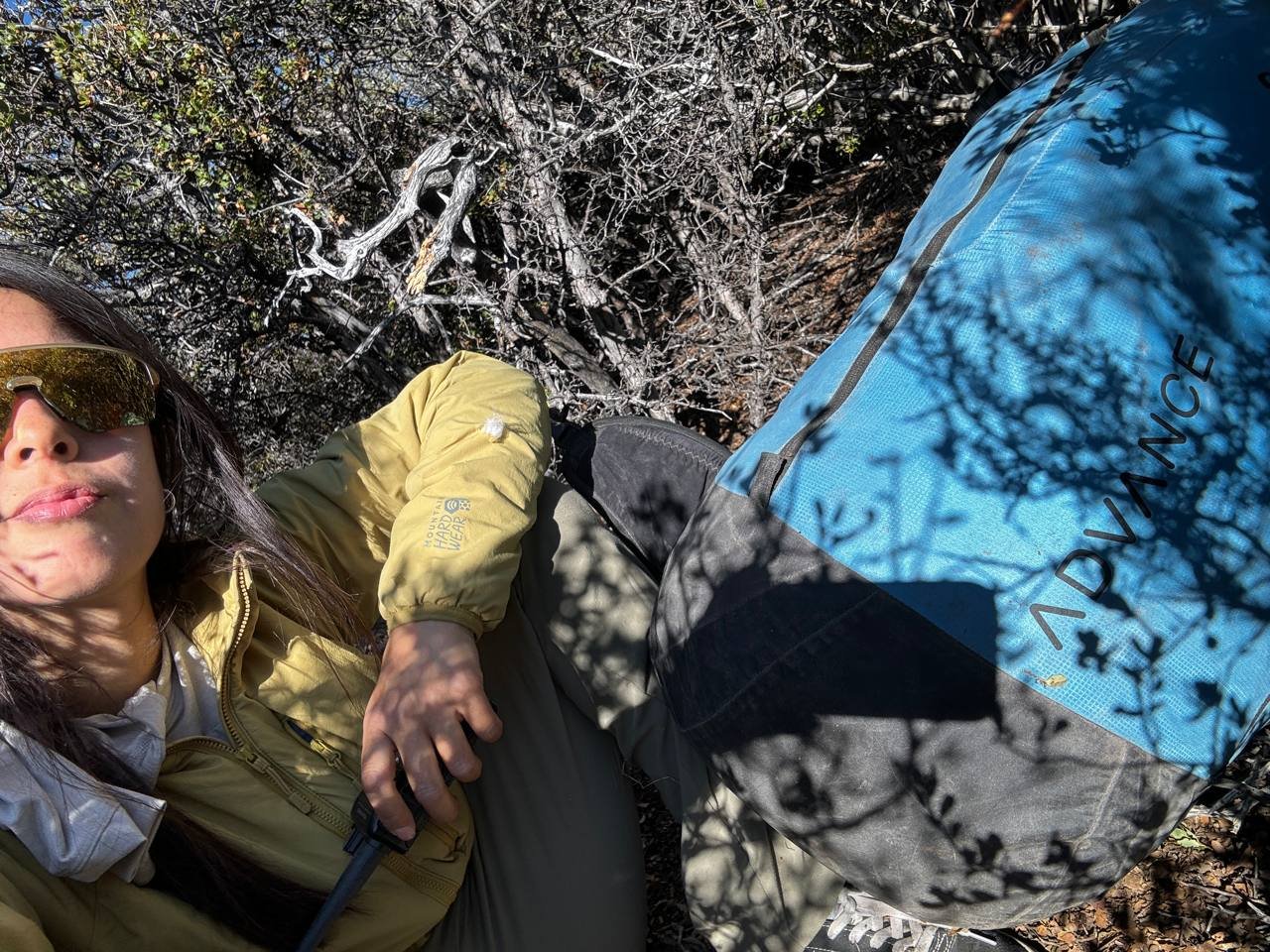
Elise Ma / 4:10 PM
All the shrubs around me are about 4-6ft
Light yellow faded color, blue and black glider pack
If needed I can partially lay out my wing laid out but still in the concertina
Andrew Karnowski / 4:12:PM
SAR is processing the request and will work on either ground or air support.
I will let you know if I hear anything else back from them.
Let us know if there’s any other way we can assist remotely
Damien Courtois / 4:15 PM (but likely a delayed posting to marginal cell
service?)
Hi all, we could use some support. Everyone is safe. Elise landed
deep in the foothills between Ortega ridge and the Sandpile. We have
determined that it's an unrealistic bushwack back to the highway. She
needs non-emergency SAR support for the following coordinates.
34.575870°N 119.320612°W
We have limited service, can someone else please call?
Jeff is above launch, we're seeing him
Andrew Karnowski / 4:17:PM
Any of the pine team, do ya’ll also have radio contact with Elise? Which
channel?
Can we confirm food, water, and clothing she has?
Elise Ma / 4:18 PM
Faded yellow jacket, blue harness pack
144.310. No food but I have 1L of water
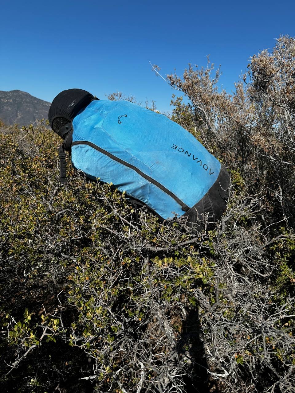
It’s flat-ish up on this ridge but covered in tall shrubs
4:25 PM
They called me and are coming soon in a helicopter, also yellow and blue.
Thank you all very much for your swift help
Much appreciated
Andrew Karnowski / 4:39:PM
SAR here is sooo awesome….
You guys have no idea how fast these heli responses are compared to other places
I’ve been
Tom Truax (SD) / 4:50 PM
response to Damien's earlier post asking for assistance
elsie_location_2025_09-13.kmz
Elise’s location in Google Earth.
Note: you need a minus sign in front the longitude to indicate West, or it will
take you to China…
Coordinate format is decimal degrees.
A 1-3/4 mile hike to the river you she goes directly down hill and follows the creek bed or 1-1/4 miles if she goes uphill to the north and down the creek on the other side of the ridge to her north, but I would recommend going directly downhill as it looks like a wider creek with less vegetation to deal with, plus going uphill through the brush even a short distance could be challenging?
Damien Courtois / 4:58 PM
Anyone in contact with SAR to know if they saw Elise?
They flew back over Pine
Andrew Karnowski / 4:59:PM
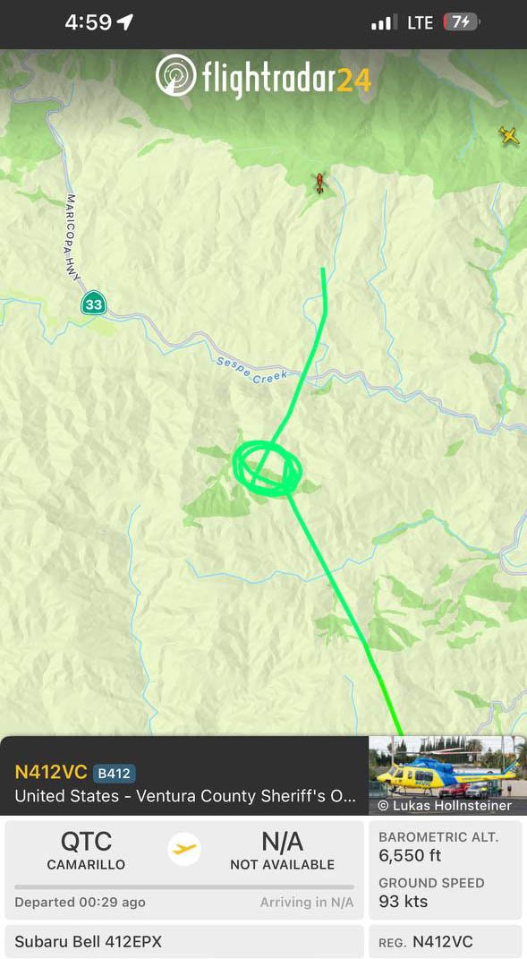
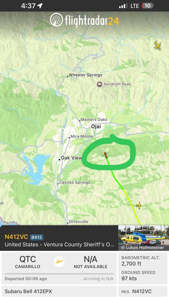
They just did a couple laps and then departed northbound.
No information other then what you see in this picture
Alex Teplitxky / 5:01 PM
They seem to be circling over Pine now
Jeremy Durazo / 5:01 PM
We’re in contact with Elise, heli seems to not find her. She’s still at the
original pin
Alex Teplitxky / 5:02 PM
Where they arrived at first was close to Elise. Now they over Pine again
Andrew Karnowski / 5:05:PM
Sheriff just called, they couldn’t find.
They will contact yall on 144.310
Sandra Acres / 5:08 PM
Do they have her phone number? During my rescue, I was on the phone with the
pilot so I could guide them. My wing was blending too much
Even with my coordinates, they needed me to tell them to turn right or left
Alex Teplitxky / 5:09 PM
They just tried to land next to us at launch but aborted. And circling again
Andrew Karnowski / 5:10:PM
It might take a minute for them to get that info with the whole phone tag system
Jeff Longcor / 5:16 PM
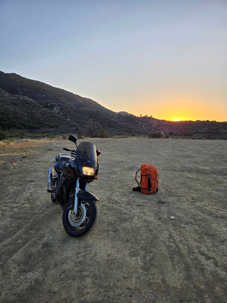
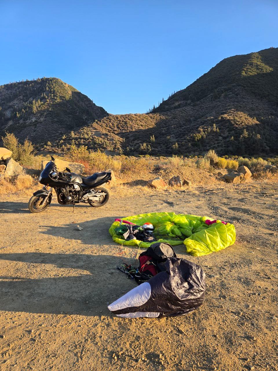
I'll likely land at my motorcycle, thanks team
Andrew Karnowski / 5:18:PM
Elise increase visibility through signals that attract attention using color,
light, and movement.
Reflective mirror/glass, waving colorful clothing item, etc.
(Phone screen as reflector or flashlight on that even)
Wouldn’t take out wing due to heli rotor.
Jeff Longcor / 5:24 PM
Any pilots near pine may want to relocate for the helicopter, if comfortable
doing so
Damien Courtois / 5:24 PM
Lit seems they found her.
Tom Truax (SD) // 5:26 PM
JLo went west across Hwy 33 about 25.6 miles SLOFD (10-minute breadcrumbs) from
his eastern turn point, then back to Pine SS takeoff. Currently (5:19) on glide
toward Ojai with 9500 MSL over Elise, but his telegram message above indicates
he will turn back for the Sand Pile because he has a motorcycle there and he
likely doesn’t want Elsie driving it down to Nordhoff?
Elise Ma / 5:45 PM
Heli is taking me to the LZ
Pine friends if you’re still there please wait
5:56 PM
They’re dropping me tons firefighter truck that will drive me to the LZ
Damien Courtois / 7:04 PM
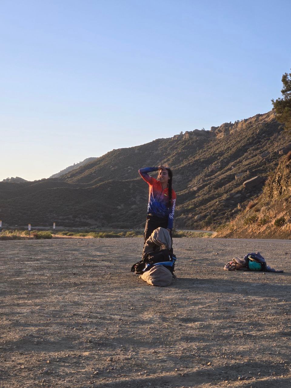
Everyone's safe, Jeff landed near his bike, thanks a ton everyone!!!
Jeff Longcor / 10:07 PM
Nice flying with everyone. Climbs improved throughout the day from broken and
rowdy to progressively smoother and more consolidated by late afternoon. A
magical convergence gave way to a lovely glass off to end the day. Mixing air
kept the landing interesting. Thanks everyone for the support throughout the
day!
[Top of Page] [Home]