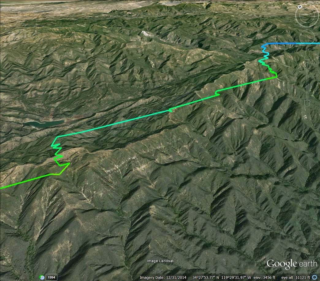
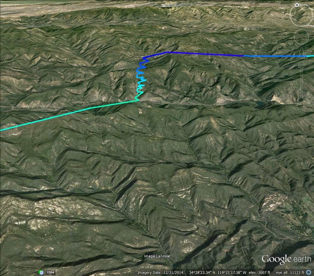
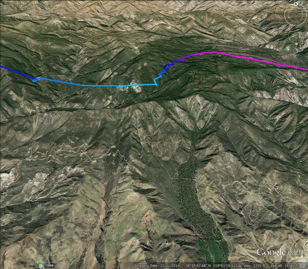
EJ Bowl to Soledad Canyon (Hwy 14) / 73 miles
|
[Home] to paraglide.net [SD Log] [Amigo] [Activity] [Photo] [Comments] [Incidents] [Weather] [SBSA] [SCPA] |
| [Amigo] > [John Scott's flight index] |
Sunday, 3/15/2015
|
John Scott (aka South Side) EJ Bowl to Soledad Canyon (Hwy 14) / 73 miles |
See Also Google Earth [KMZ
File] and or [IGC
Data File]
Note IGC data file was converted from John's Garmin GPX file without time info,
so the time data is based on an estimated takeoff time of 1 PM PST.
Article Copied from:
http://scpa.info/bb/forum/viewtopic.php?f=1&t=3172
Posted: by Southside » Mon Mar 16, 2015 9:46 am
Last edited by Southside on Fri Mar 27, 2015 2:44 pm,
Had a nice flight from EJ Bowl yesterday, landing at Sand Canyon Road and the Hwy14 for 73 miles after waiting out the sun line. Low 4s through SB then 7+ just short of the Powerlines. Bypassed both Noon and Whiteledge (after tanking up at Divide) heading for Bump 3. Climbed out again to 7k just short of Bump 3 and then basically copped a glide to Three Stooges (stopped at Nordoff for a couple of turns but the air was bit too textured for my blood). Despite the high climbs earlier in the flight I actually almost flushed off of Chief's. A low save from the foothills in front of West Repeater kept me in the ball game. Back to the high 7s over Boyds and then close to 9k over Santa Paula Peak. After a few turns over the foothills just east of Fillmore that didn't amount to much I took my altitude and headed to Piru. Started to pick out landing fields about half way to the 5 from Piru, but I had a nice low save that got me back to the mid 7s. The thermal changed my goal to Sylmar. However, the high peak between Simi Valley and Chatsworth was completely shaded in and 7k ended up not being quite high enough to clear the San Gabriels on a glide. And at the point I had caught up with the shade line so I just veered to the left for a glide to the 14.
Copied from:
http://socalxc.blogspot.com/2015/03/ej-bowl-to-soledad-canyon.html
Posted by John Scott
Sunday, March 22, 2015
EJ Bowl to Soledad Canyon
I really can't remember the last time that I've flown through the Casitas Pass from Santa Barbara. It must be at least 5 years. Generally speaking, unless there is a strong east wind, if you make it through the Pass you've got at least Santa Paula made. One year way back when I made it to at least Santa Paula 5 times. Since then, seasons have gone by where I haven't made it though at all. On days that have potential it's either too strong north or cloud base is too low or in the case of Santa Ana conditions, too east to go anywhere. In other words, everything has to align just right and that just doesn't happen that often, especially when your flying is limited to weekends.
Sunday it was neither post-frontal nor Santa Ana, two conditions where Santa Barbara works the best. However, the weatherman was calling for record high temperatures. All the models were calling for at least 7k tops for Ojai and light SW winds through the boundary layer. But, and there is always a but, there was a prediction of a high cloud deck. How would it affect the rest of the forecast?
For me, it didn't matter. My daughter is back for spring break and she brought a couple of her friends with her. One of the things that she wanted to do with them was chase for me. Sunday looked as good a day as any.
Three potential drivers, but no one to drive for. The high clouds kept everyone home, including the person who would have been my flying partner for the day, but, had a change of heart between the time we left the house and the time we showed up at his doorstep. I made one other phone call when we got into Santa Barbara, but still no takers.
We arrived at EJ Bowl all alone around 10. Considering the recent time change it was early regardless of the thick cloud cover. But, it left plenty of time for the blue hole to the west of us to work its way over to us and still have the time for a good flight. It took 3 hours. Ladies, welcome to hang waiting. In the interim, a truck load of PGS showed up to fly. However, none wanted to wait for the sun to arrive and all flushed off the hill in the shade. By the time I launched around 1:00, after waiting for the sun line to bathe the RR for a bit, I was the only one left around.
Before launching I told my daughter that I'd know right away whether we were going to have an early lunch on Stern's Wharf or a chase towards home. After two or three 360s above the RR I got on the radio to tell her to get on the freeway and point the truck south. Low 4s at the RR and then again at the Thermal Factory. The shade line was just to the east of me so I had to stop and hang out on the east spine of Montecito Peak and then again at the Romero Saddle to wait for the sun to hit the next spine down the road. However, once Castle Ridge brightened I didn't run into the shade line again until near the end of my flight.

Climbs at the west end of Power Line Ridge and West Divide Peak
Start of Casitas Pass
All the usual points worked perfectly fine until the last spine before the powerlines. There I hit one of the best thermals of the day, climbing out to the mid 7s, probably the highest that I have ever been at that spot. High enough to bypass Noon Peak completely and head directly to Divide Peak. Back to the mid 7s there for a glide through the Casitas Pass.

Climbing in front of the Back Step along White Ledge Ridge / East of White Ledge
Peak,
just short of bump three
After a couple of lazy circles above Whiteledge I took my altitude and B-lined it for Bump 3. However, about half-way there I found another great thermal over a nondescript area that topped out close to 8k. From there it was basically a straight glide to the Three Stooges.
I stopped at Nordoff for a couple of turns but the air was a bit too textured for my blood. As usual Three Stooges was good enough for a skip over to Chiefs. However, despite being probably the most reliable spine on the range, I could not climb out. I was forced to fly off of Chiefs low to the foothills in front of West Repeater.
Of all the places to flush off from. Luckily I found something. Soon I was back to the mid 7s drifting to Boyds. By the time I left Puckers for Santa Paula Peak I was up to 8k. At Santa Paula Peak I got up to close to 9k, the highest point of the flight.

Close to 9k above Santa Paula Peak
I was probably too high for the thermals above Fillmore. I took my altitude to about half-way to Interstate 5 from Piru where I started picking out landing fields. But the day was good for one more thermal.
The goal at the start of the day was the Interstate, but at 7k just short of it I set my sights for Sylmar. However, the high point between Simi Valley and Chatsworth was completely shaded in and after testing my glide angle toward Sylmar, 7k just wasn't quite high enough to clear the San Gabriels. 500 ft. more probably would have done it. Now in the shade, I took whatever altitude I had left and stretched a glide to Soledad Canyon, landing at Sand Canyon Road at the 14. The flight measured out 73 miles, my longest from Santa Barbara.
See Also You Tube Video at: https://www.youtube.com/watch?v=glIPWbak9Jc / First 20 miles only (limited battery?)
Plus Google Earth 3D [KMZ File] and or [IGC Data File]
[Top of Page] [Home]