2 hours 54 minutesairtime
Launch 11:00:06 AM PST
Land at 1:55:10 PMPST
Max Altitude about 6,000 feet
|
[Home] to paraglide.net [SD Log] [Amigo] [Activity] [Photo] [Comments] [Incidents] [Weather] [SBSA] [SCPA] |
| [Amigo] > [Jonathan Dietch flight index] |
Saturday, 11/8/2014 [Flight Articles]
by [Neal] [Jonathan]
[Sundowner] [John Scott] &
[Tim Barker]
[Weather Archive & Percepton] [Google
Earth Track Log Index for All] [All
Posted Photos]
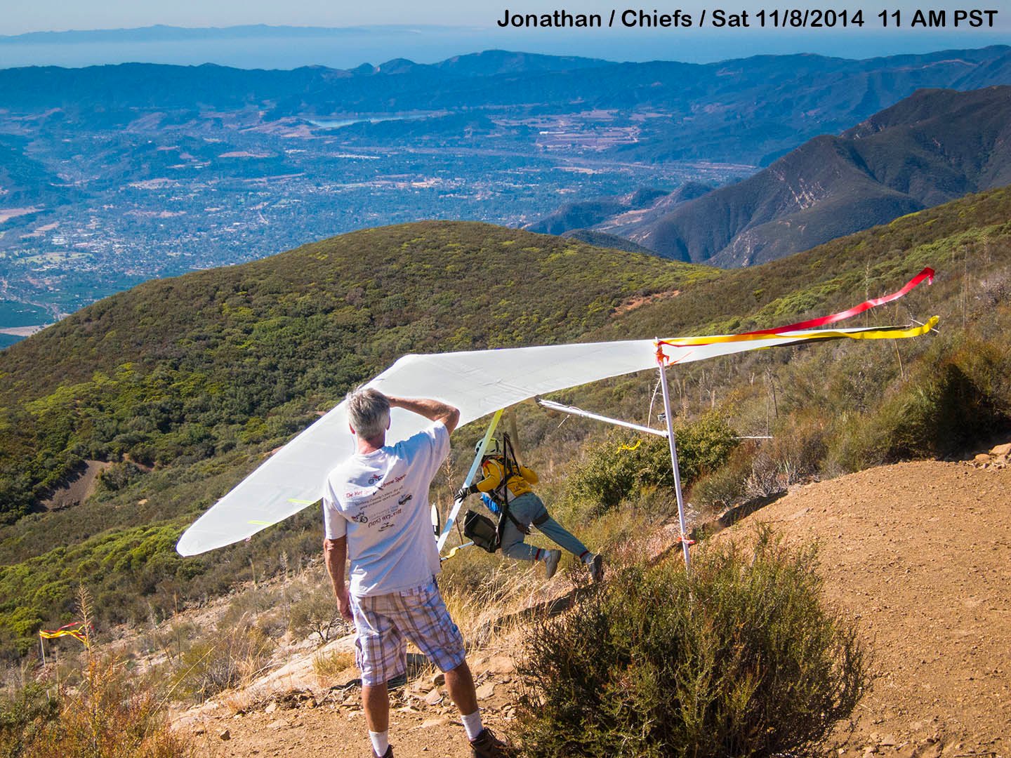
Jonathan Dietch (aka NMERider or JD)
Chiefs Launch (Ojai) to East Beach (Santa Barbara)
Saturday 11/8/2014
| About 29.3 Miles from Launch to Landing 2 hours 54 minutesairtime Launch 11:00:06 AM PST Land at 1:55:10 PMPST Max Altitude about 6,000 feet |
See Also: Jonathan's [Google Earth KMZ Track File file], [IGC Text Data], and [Photo Set from All Pilots]
Article Derived Jonathan's postings starting at:
http://scpa.info/bb/forum/viewtopic.php?f=1&t=3089#p9163
Initial Post by NMERider » Sun Nov 09, 2014 1:01 am
Great day at Chief Peak w/ good turnout. Thanks to Eddy for driving for us hangies. I'm working on the video bit by bit. Here are some frame stills to give an idea of the day.
click image for full size
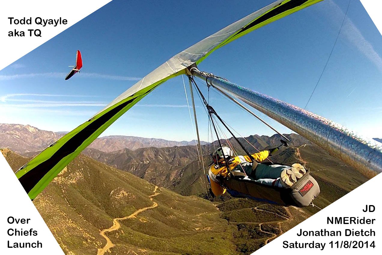
TQ by Chief
Peak ↑ (click image for full size)
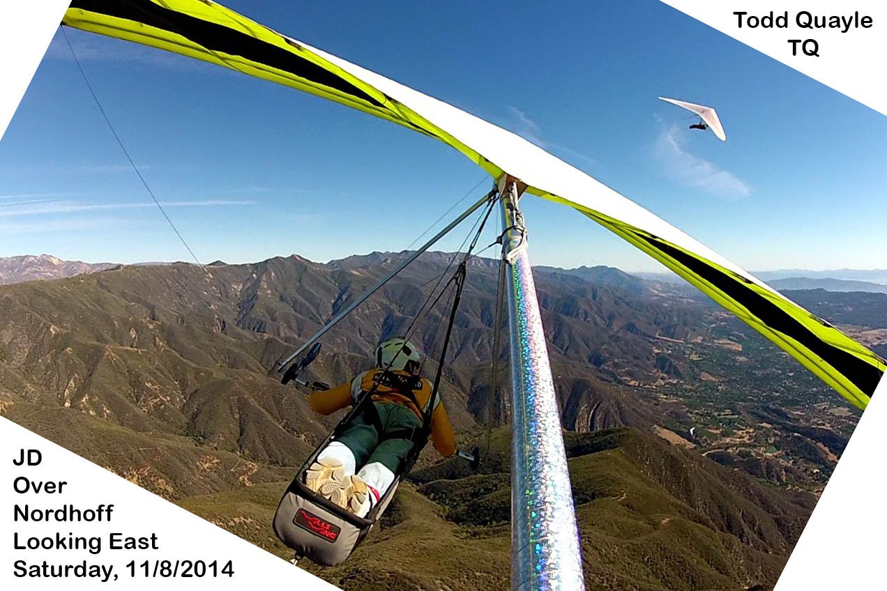
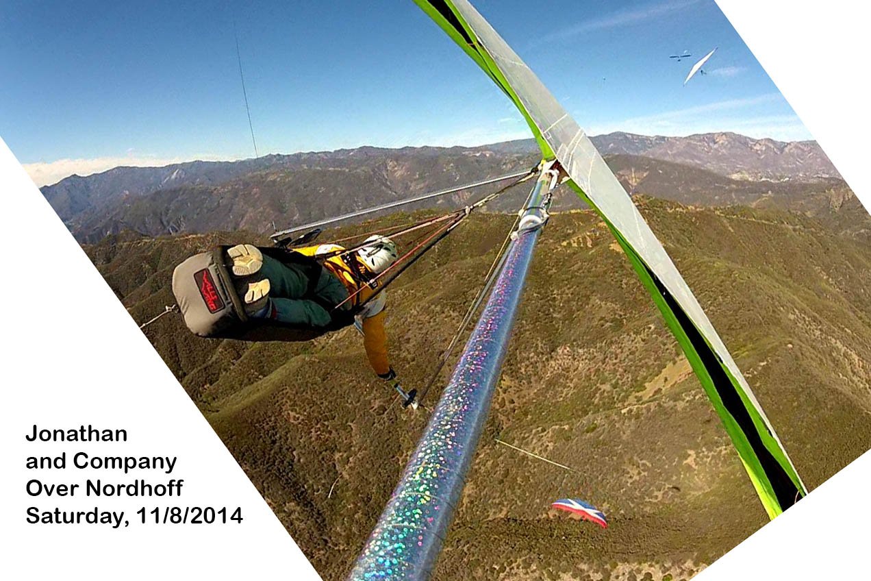
TQ by
Nordhoff ↑ (click image for full size)
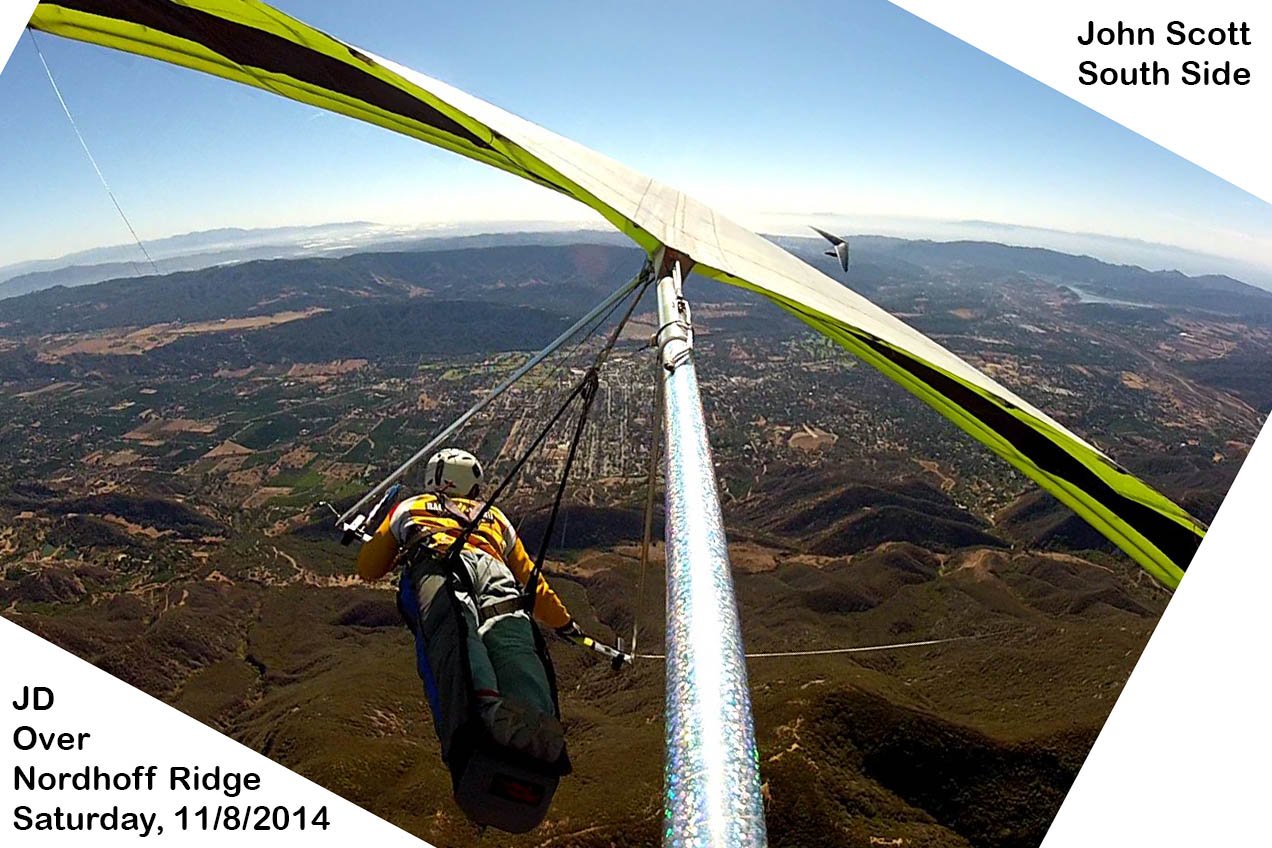
South Side out
front of Nordhoff ↑ (click image for full size)
Small gaggle
(sort of) by Nordhoff ↑ (click image for full size)
Name that PG?
↑ (click image for full size)
Name that PG?
↑ (click image for full size)
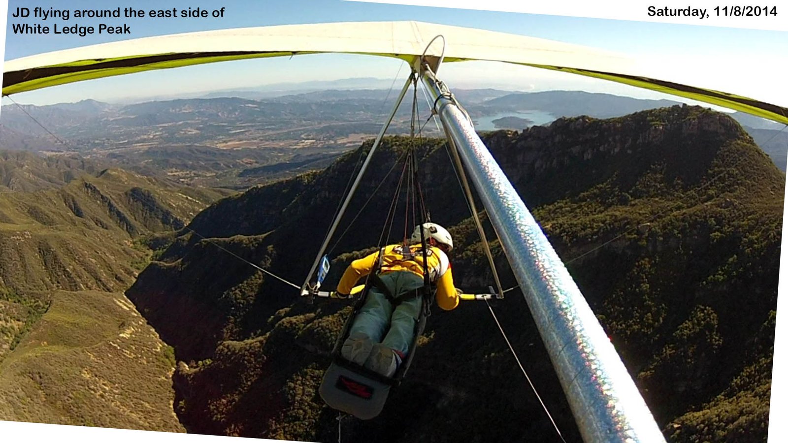
Driving in to
some ridge or other before Whiteledge ↑ (click
image for full size)
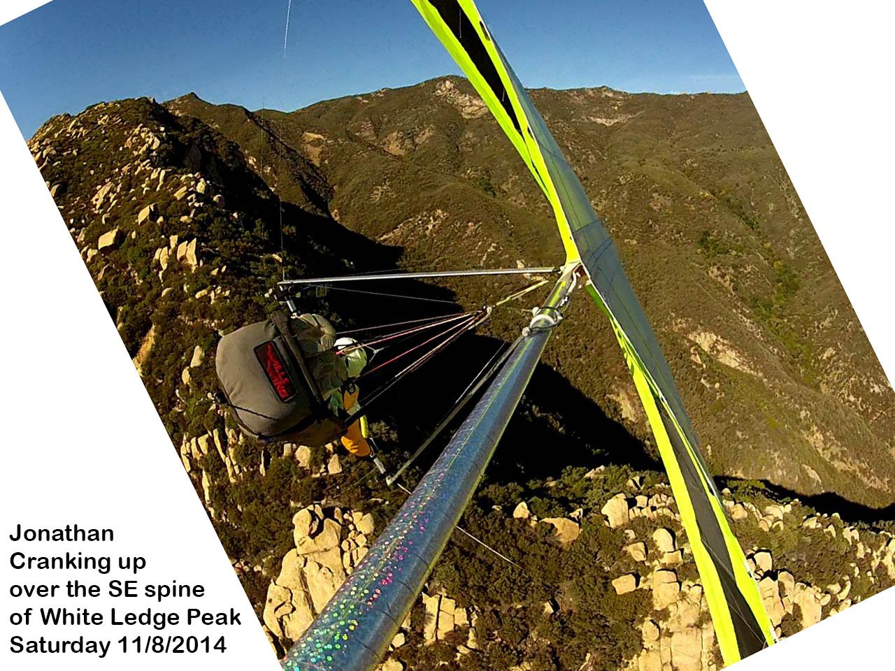
Face first at
the boulder lining Whiteledge spine ↑ (click image
for full size)
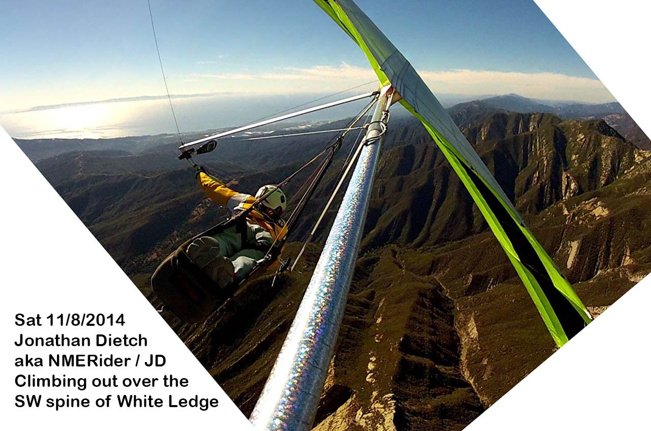
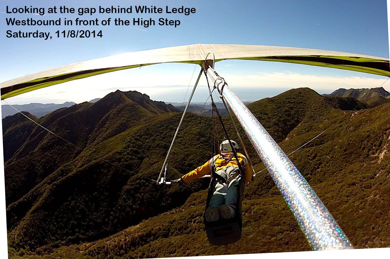
Finally
topping out before heading West across the pass ↑
(click image for full size)
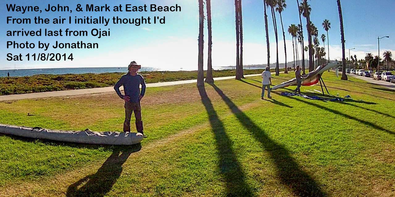
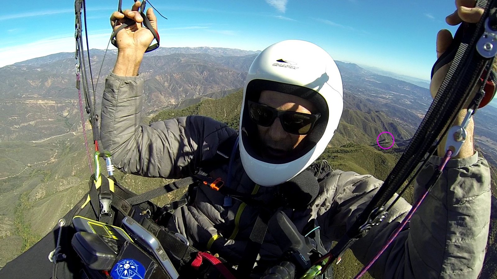
Wayne, John & Mark at East Beach. From the air I initially thought I'd arrived
last from Ojai

Tracks from me, Southside, Neal & SD ↑ (click
image for full size)
Posted by NMERider » Sun Nov 09, 2014 9:46 pm
flychild wrote: quote
....good motivation to make it over the pass this time around. Thanks Tom. Had
to work hard on the east side to get over though. We weren't skying out on the
east side off the pass, that's for sure. Actually got highest, about 6K, over
chiefs on the first climb of the day.... end quote
Jonathan Comment:
From out of my radio speaker while I'm setting up my HG comes,"...just went
through six thousand and still climbing....". That's what I call motivation.
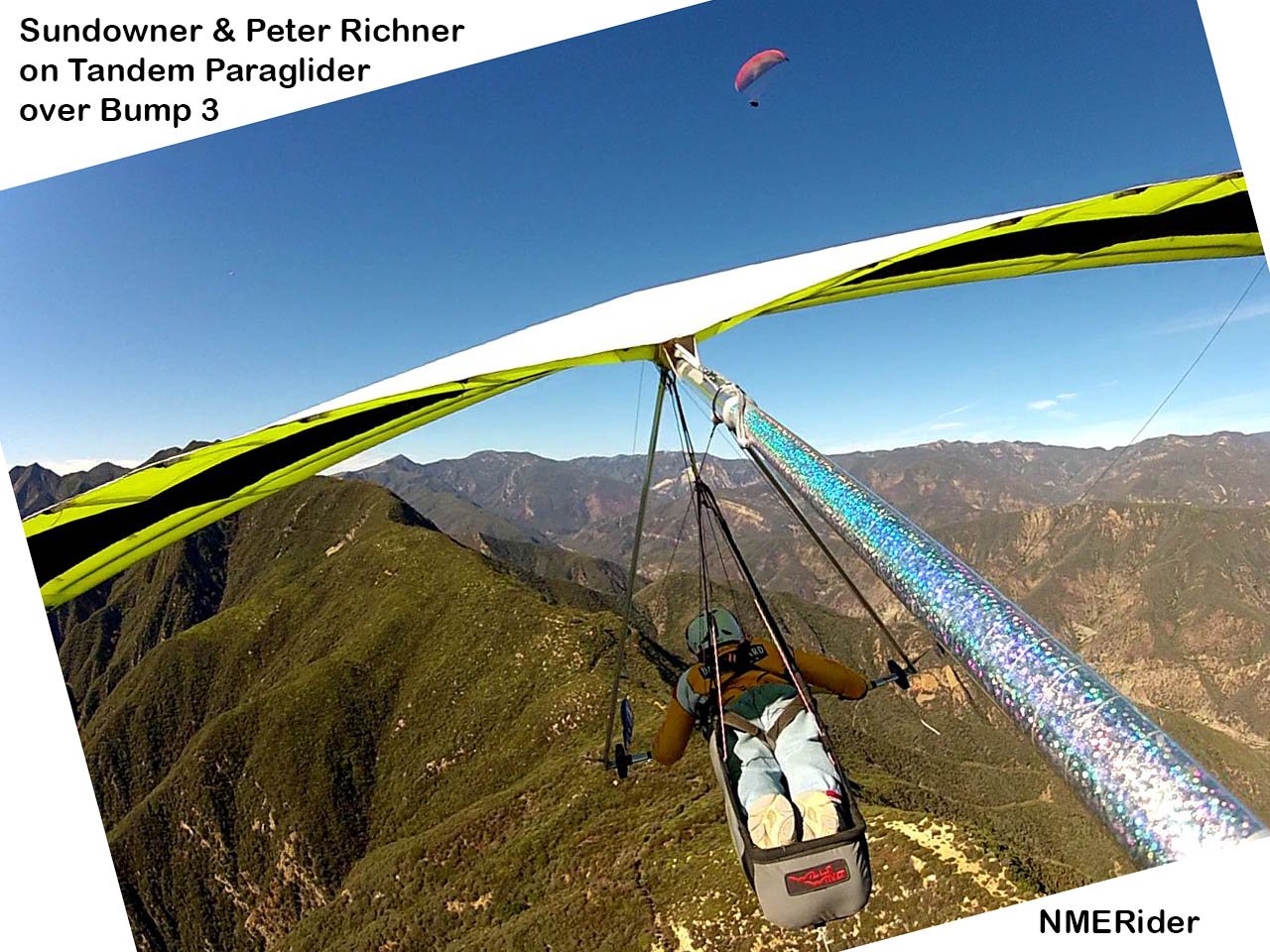
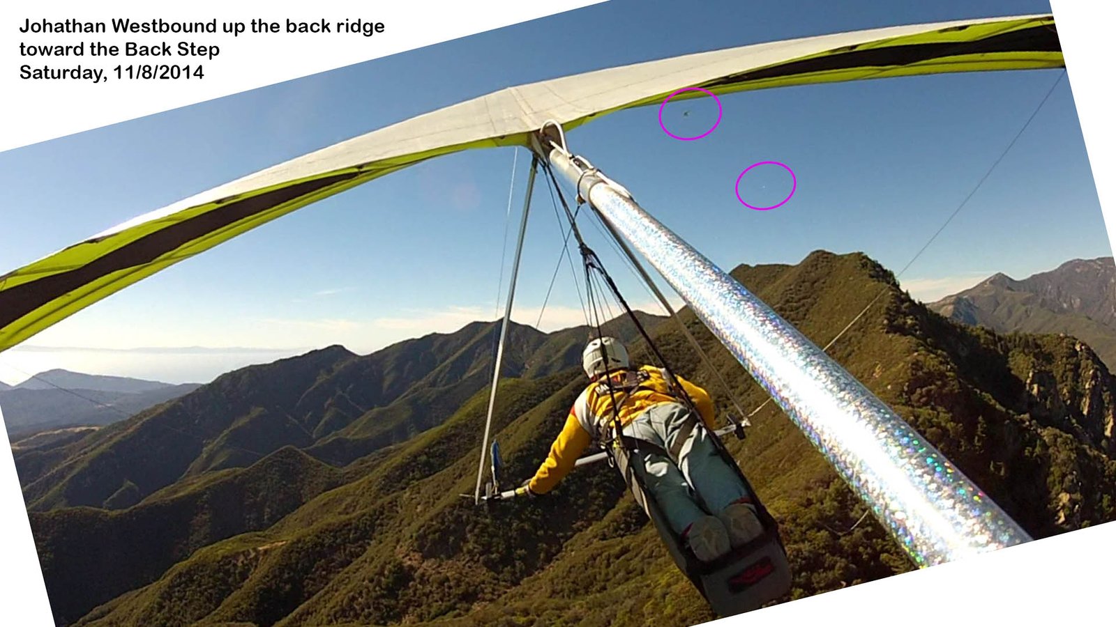
![]() I saw you and SD
briefly during my initial ingress of Whiteledge. SD appears in the following
frame still. I'm not sure if you're visible but I have our tracks correctly
synced and you're close-ish.
I saw you and SD
briefly during my initial ingress of Whiteledge. SD appears in the following
frame still. I'm not sure if you're visible but I have our tracks correctly
synced and you're close-ish.
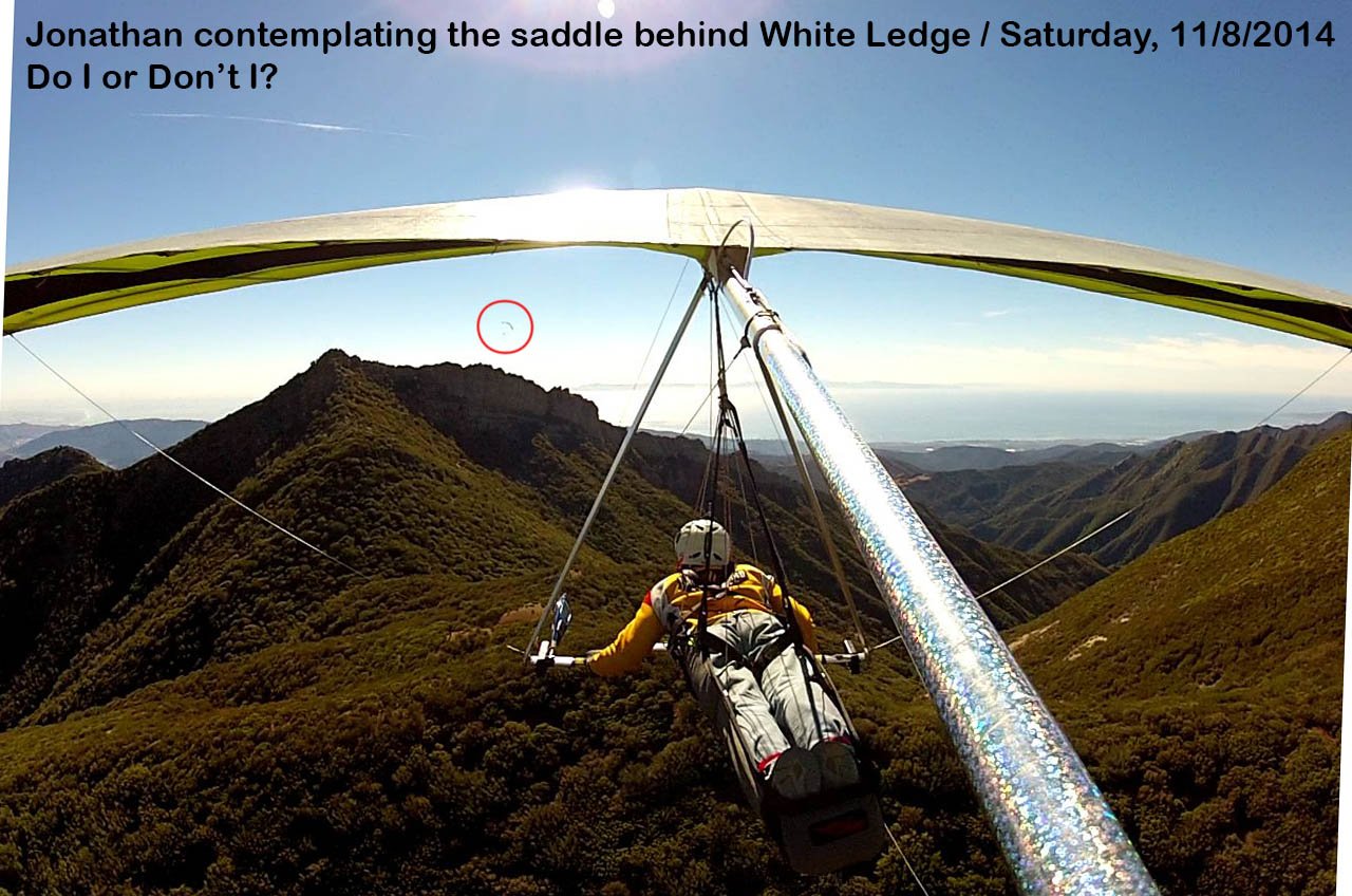
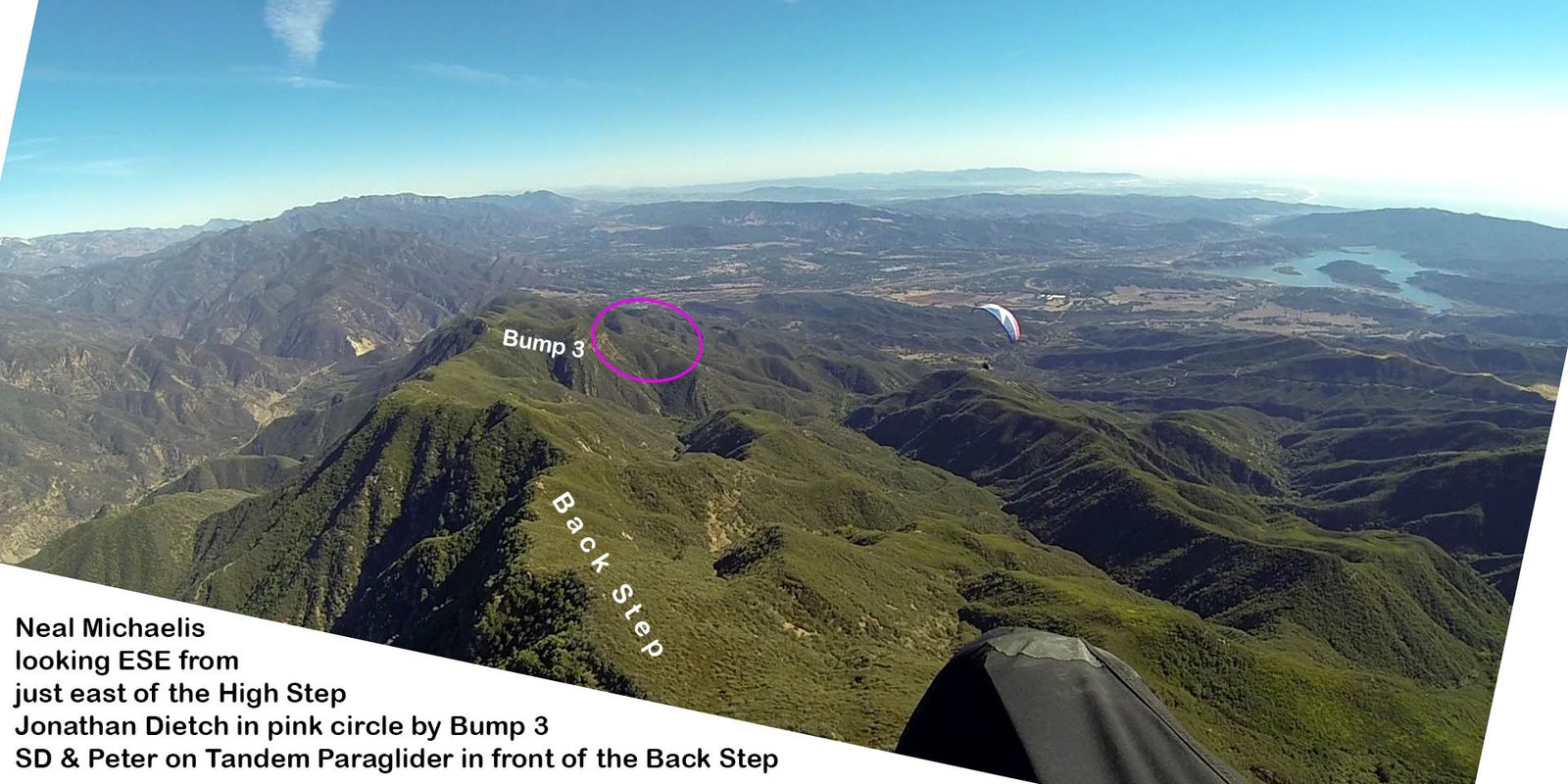
Do I or don't I? ↑ (click
image for full size) / Peter & Sundowner circled in red on the SW spin
I didn't have the testicular fortitude to shoot through that gap.
I'm sorry we didn't have a group all land at the beach. Would have been some
party.
Feel my pain! :-O
Posted by NMERider » Wed Nov 12, 2014 11:23 am
Well, the video edit just got more interesting. flychild sent me a video clip
of his crossing of Whiteledge. I synced our video tracks together and here are a
pair of contrasting perspectives from within seconds of one another. Can you
feel my pain? ![]()
Grovelling at
the first trigger w/ Southside, flychild all doing well (circled in pink) ↑ (click
image for full size)
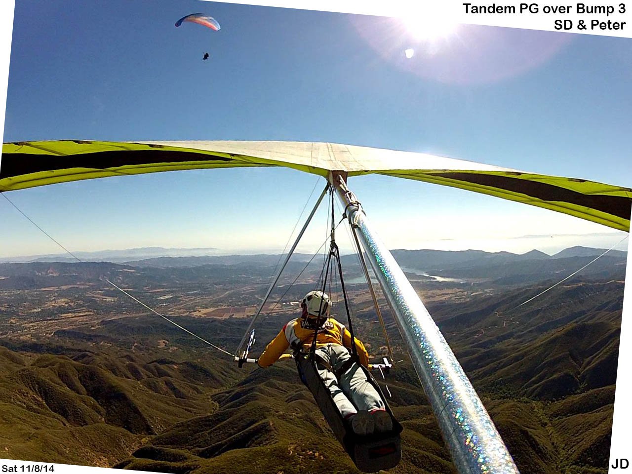
Climbing w/
sd while Southside and NME grovel in the distance (circled in pink) ↑ (click
image for full size)
Flushing down the SE spine of Whiteledge while flychild
crests the summit and heads West behind me out of sight. ↑ (click
image for full size)
Cresting Whiteledge as NME flushes down the SE spine (circled in pink). ↑ (click
image for full size)
Saturday, 11/8/2014 [Flight Articles]
by [Neal] [Jonathan]
[Sundowner] [John Scott] &
[Tim Barker]
[Weather Archive & Percepton] [Google
Earth Track Log Index for All] [All
Posted Photos]
[Top of Page] [Home]