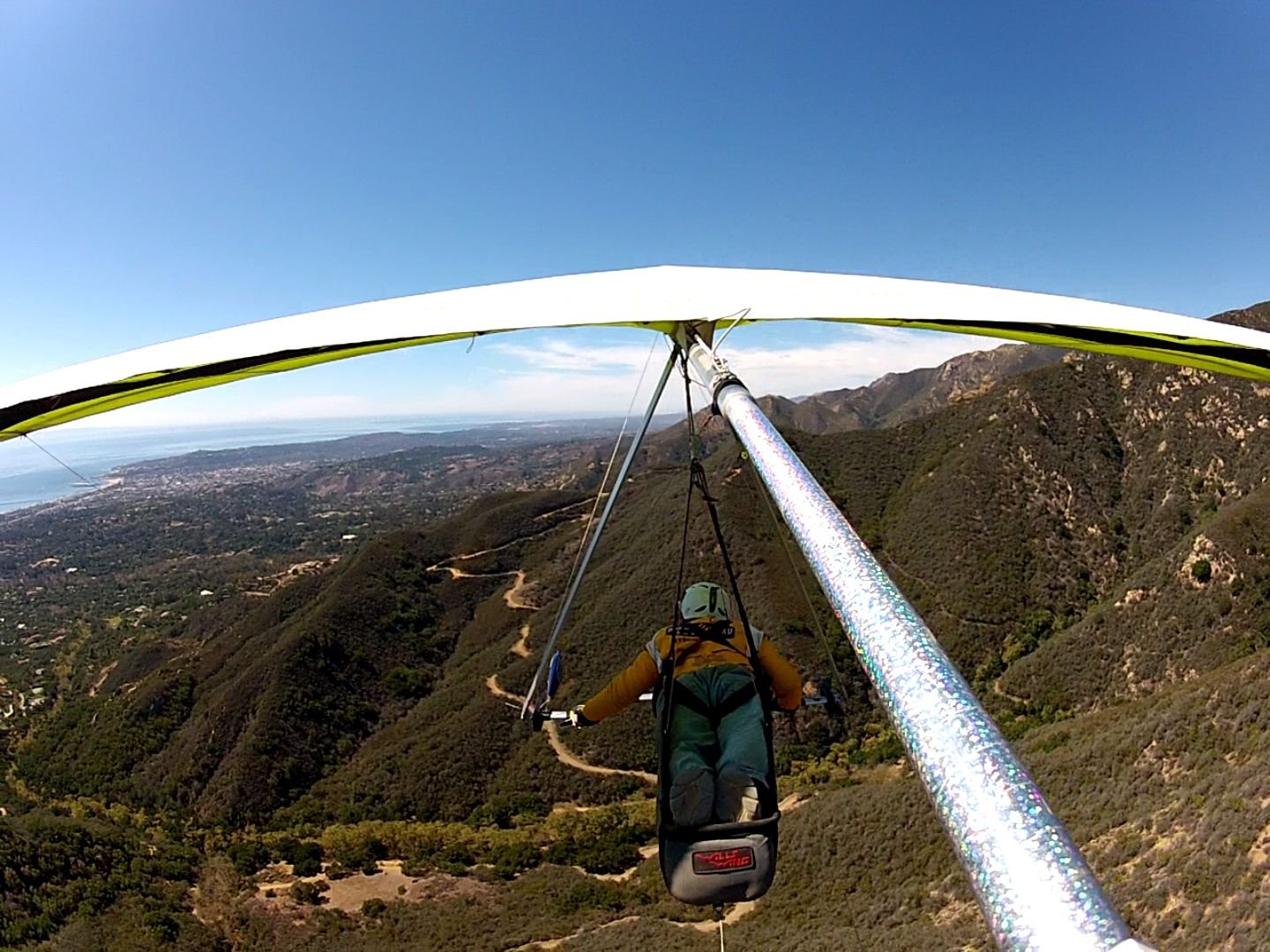
Max Altitude 7600 feet
Launch Nordhoff Peak about 11:30ish, 4480 feet
Land on East Beach, Santa Barbara
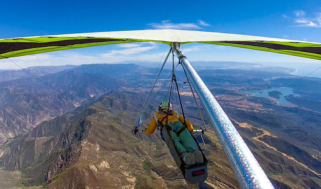
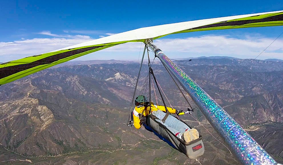
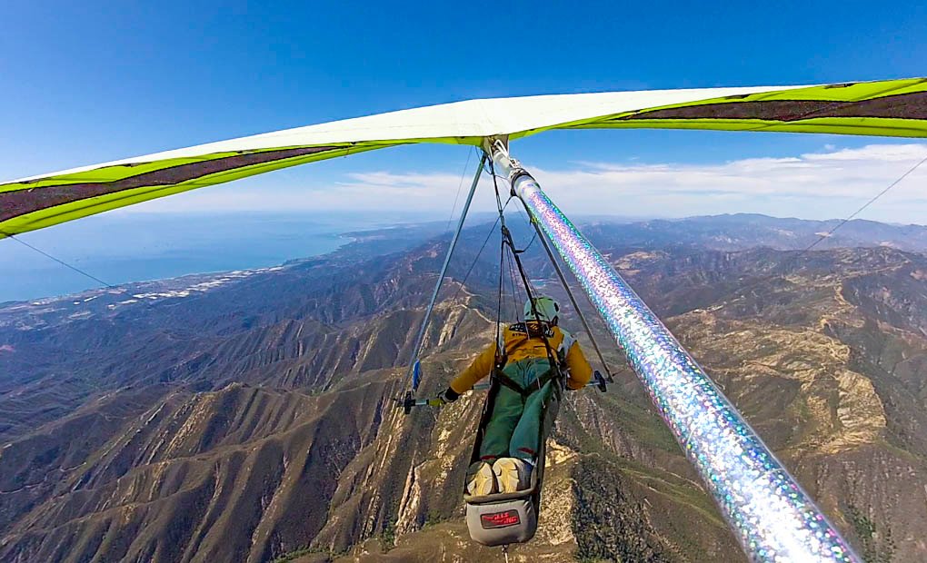
Wills Wing T2C 144 / Hang Glider
|
[Home] to paraglide.net [SD Log] [Amigo] [Activity] [Photo] [Comments] [Incidents] [Weather] [SBSA] [SCPA] |
| [Amigo] > [Jonathan Dietch flight index] |
Saturday, 10/4/2014 [Weather]
and [Flight Articles]
by [Cort] [Jonathan] & [Sundowner] plus [SD
Photos] & [Misc Post]
3D Google Earth Track Paths for [Jonathan]
[Neal]
and [Sundowner]
Jonathan Dietch (aka NMERider or JD)
Nordhoff Peak to East Beach in Santa Barbara
Saturday, 10/4/2014
See Also [3D Track Path / Google
Earth KMZ] downloadable [Photo Set]
Video Links:
http://youtu.be/oMyf-ET63EkNMERider
Landing & http://youtu.be/GuYrX0LEW-s
Altitude Perception
| 25 Miles from Launch to Landing Max Altitude 7600 feet Launch Nordhoff Peak about 11:30ish, 4480 feet Land on East Beach, Santa Barbara Wills Wing T2C 144 / Hang Glider |
Article Copied from
http://scpa.info/bb/forum/viewtopic.php?f=1&t=3076#p9137
Posted by NMERider » Sat Oct 04, 2014 10:19 pm

Grantham's new rack
What an epic fun adventure day for so many pilots! It's funny to think I flew Nordhoff to East Beach and it was a blown flight.
7600' @ Whiteledge
7600' @ Whiteledge
7600' @ Whiteledge
I have a tremendous amount to learn.
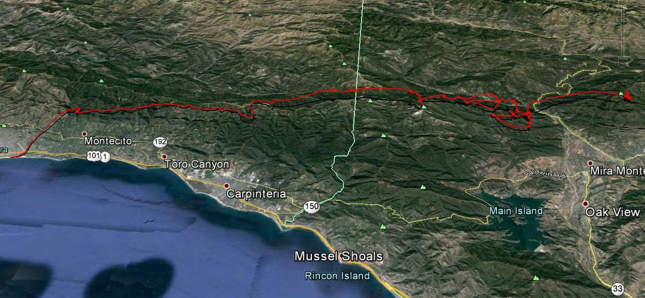
My sad tracks
[3D Track Path / Google Earth KMZ]
Need Google Earth installed on your computer
The glass-off reports from Pine were incredible and SD pulled off another
unprecedented move.
I will defer to SD for the details. I will eventually get my scrappy scratch
flight video fully edited.
Can you feel my pucker from 3.6-miles to East Beach?
At least I stuck the landing at East Beach in 4 to 5 mph tailwind.
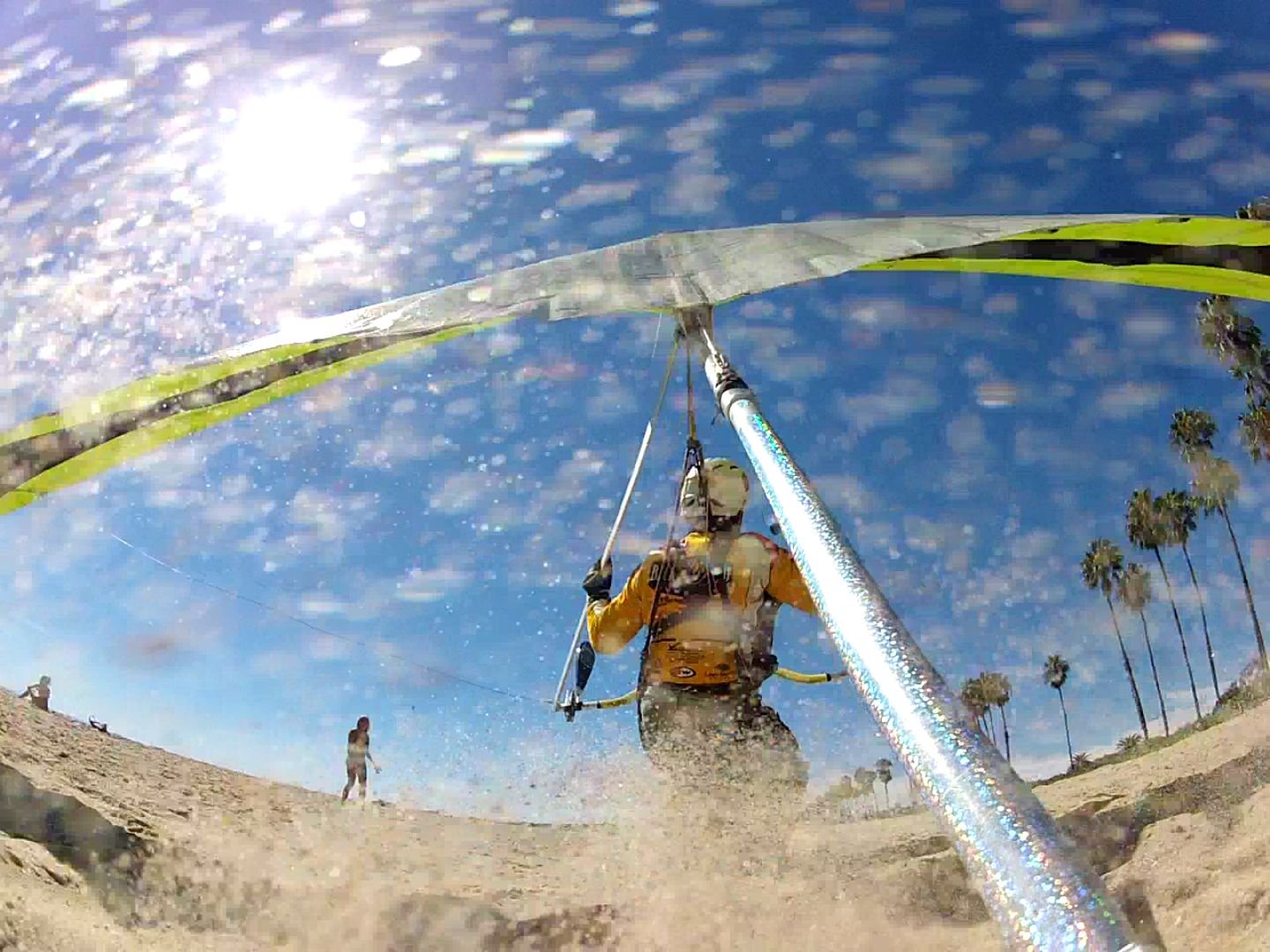
Flare-gasm
How it came to a stop:
http://youtu.be/oMyf-ET63EkNMERider
by NMERider » Tue Oct 07, 2014 4:18 pm
I ran a more detailed edit of my flight with emphasis on how I found myself with
so little residual altitude when I arrived at the East end of East Beach.
http://youtu.be/GuYrX0LEW-s
Other than failing to double-check my adjusted barometric altitude against my GPS altitude both at launch and during flight for verification of glide slopes needed, I simply was in too big a rush and failed to hold the high ground which cost me the ability to make the return trip to Nordhoff and possibly do much, much more later in the day. If X/C flying wasn't a continual learning experience it wouldn't be nearly as satisfying now would it?
Saturday, 10/4/2014 [Weather]
and [Flight Articles]
by [Cort] [Jonathan] & [Sundowner] plus [SD
Photos] & [Misc Post]
3D Google Earth Track Paths for [Jonathan]
[Neal]
and [Sundowner]
[Top of Page] [Home]