Saturday, 9/14/13
|
[Home] to paraglide.net [SD Log] [Amigo] [Activity] [Photo] [Comments] [Incidents] [Weather] [SBSA] [SCPA] |
| [Amigo] > [Bob's (aka yna or Cougie or BobA) flight index] |
Saturday, 9/14/13 [Weather Archive] and [Flight Articles] by [BobA] [NMERider] [Sundowner] [Fly Above All]
|
Bob Anderson (aka yna / Cougie / BobA) Saturday, 9/14/13 |
Pine Mountain to I-5
Article Copied from:
http://scpa.info/bb/forum/viewtopic.php?f=1&t=2880#p8611
Posted by BobA » Sun Sep 15, 2013 1:05 pm
Pine was pretty fun. Nice climbs, light winds. Not too cold, not too
hot. Great to spend XC time with Diablo, Sundowner, and Johnathan.
Many thanks to Diablo for driving!
![]()
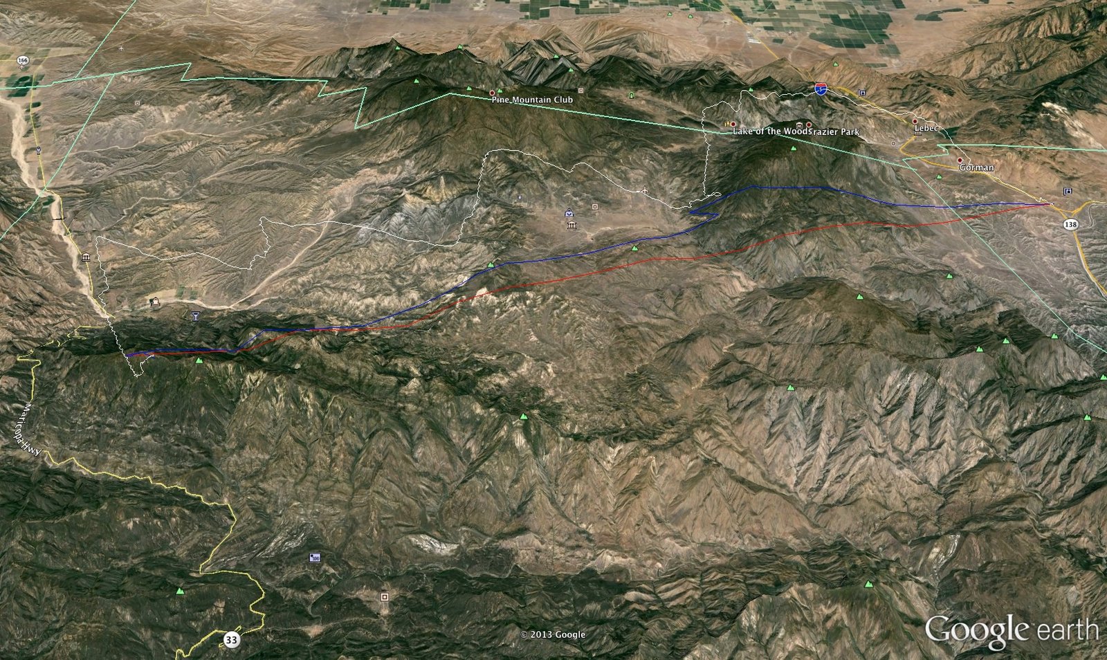
Click image for full size
The red line is the straight line for longest distance of track, the blue line
is more actual distance - a bit kinked and cuts the corner at the end though...google
earth stuff
Editors note: I think the white line represents altitude: